 1 hour ago
The real battlefield isn't all of Iran. It's the coastline. Mapping recent US strikes reveals why Tehran can still threaten ships in the Strait of Hormuz.
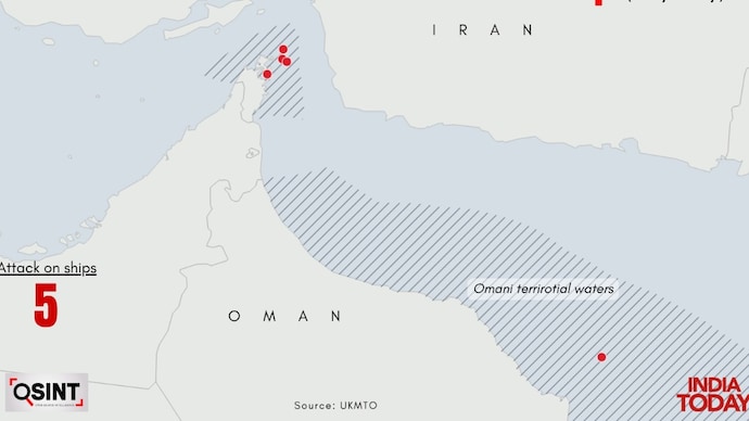
Iran has struck 5 vessels crossing Hormuz using US-designated route since July 7

New Delhi,UPDATED: Jul 14, 2026 19:12 IST
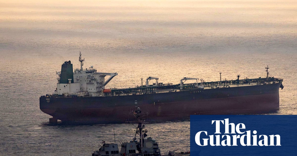
US President Donald Trump has repeatedly claimed that Iran's navy has been "decimated." Yet hours after Washington announced the resumption of its maritime blockade on Iranian ports on Monday and declared itself the "Guardian of the Hormuz Strait," Iranian cruise missiles struck two commercial tankers transiting Omani territorial waters, MT Al Bahiyah and MT Mombasa.
In response, the US struck military targets across Iran, including Bushehr, Chah Bahar, Jask, Konarak, Abu Musa, and Bandar Abbas.
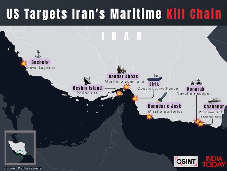
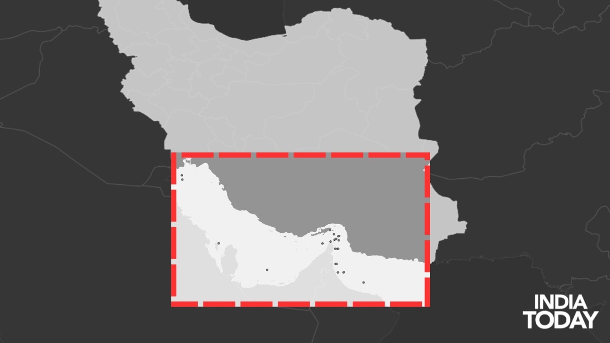
The attack highlights a growing pattern in the conflict. While the war now stretches across much of Iran, the latest pattern of US strikes points to a far more specific objective: dismantling the coastal network that enables Tehran to threaten commercial shipping in the Strait of Hormuz.
An India Today OSINT analysis of geolocated US strikes suggests Washington is increasingly targeting Iran's "maritime kill chain" - the network of coastal surveillance, command centres, naval bases, logistics hubs, maintenance facilities, missile batteries and drone infrastructure that enables Tehran to detect, track and attack vessels passing through one of the world's busiest shipping corridors.
The analysis examines why these coastal targets have become the focus of recent US operations and how, despite heavy losses to its conventional navy, Iran continues to threaten commercial shipping through one of the world's busiest maritime chokepoints.
THE TARGETS DRIVING US STRIKES
The latest round of escalation was triggered by the July 7 Iranian strike on a commercial vessel, an incident that marked the collapse of the relative calm that followed the ceasefire and the signing of the 60-day memorandum of understanding between Washington and Tehran.
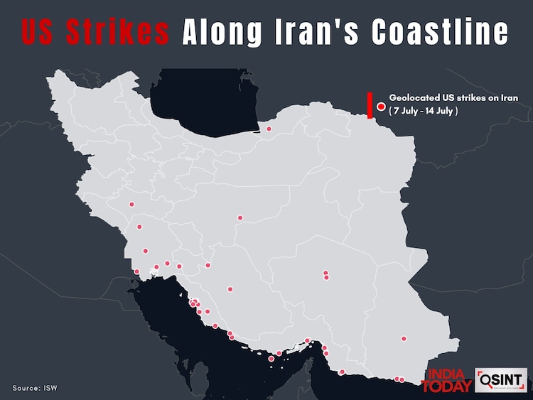
The mapping shows that while US strikes now span multiple parts of Iran, recent target selection has increasingly clustered along the country's southern coastline overlooking the Persian Gulf, the Strait of Hormuz and the Gulf of Oman. The locations correspond closely with critical elements of Iran's maritime architecture.
According to the US Central Command (CENTCOM), recent operations have struck coastal radar installations, missile batteries, drone launch facilities, maritime command centres, naval bases and maintenance infrastructure across southern Iran. Among the key locations targeted are Bandar Abbas, Bushehr, Sirik, Jask, Konarak and Chabahar, along with facilities on strategically important islands commanding the Strait of Hormuz.
Bandar Abbas sits at the heart of Iran's maritime network. Home to the headquarters of the Islamic Revolutionary Guard Corps (IRGC) Navy and one of the country's largest naval bases, it coordinates operations across the Strait while also housing submarine and surface fleet maintenance facilities.
The strike on Bandar Abbas also marked a first in US military history. CENTCOM said three Corsair unmanned surface vessels struck a submarine and ship maintenance facility inside the naval base, marking the first combat use of one-way American sea drones. Unlike previous strikes carried out from the air, the one-way surface drones infiltrated Iranian waters before exploding inside the facility. CENTCOM said the operation was intended to degrade Iran's ability to continue attacking commercial shipping, underscoring Washington's growing emphasis on dismantling the logistics and maintenance backbone of Tehran's maritime kill chain rather than simply destroying frontline naval assets.
Further east, Sirik and Jask occupy commanding positions along Iran's Makran coastline - a coastal strip stretching along the Gulf of Oman and Arabian Sea, spanning from the Sistan and Baluchestan province in southeastern Iran to Pakistan's Balochistan province. An area long identified as a key deployment zone for coastal anti-ship missile batteries capable of covering approaches into the Gulf of Oman.
Konarak and nearby Chabahar support logistics and forward deployments, while Bushehr remains a major naval logistics and support hub for operations in the Persian Gulf. Together, these sites form the backbone of Iran's maritime surveillance, sustainment and strike architecture, allowing Tehran to monitor, coordinate and support operations across the Strait of Hormuz.
HOW IRAN HITS SHIPS WITH A 'DECIMATED' NAVY?
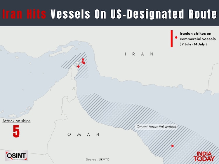
Iranian attacks on commercial vessels have continued despite repeated US strikes. Since July 7, at least five commercial vessels have come under attack in Omani territorial waters, according to the UK Maritime Trade Operations (UKMTO), including the two tankers struck this week along a route the US had designated for the safe passage of commercial shipping.
Additionally, responding to what Donald Trump described as the resumption of a US maritime blockade, dubbed "Blockade 2.0", Iranian Foreign Minister Abbas Araghchi asserted that Iran "has always been the guardian of the Strait and will remain so forever."
Taken together, the attacks and Araghchi's remarks underscore that even as Iran's conventional naval assets come under sustained pressure, the coastal network enabling maritime attacks remains operational, giving confidence to Tehran.
That strategy reflects decades of Iranian military planning. According to the Center for Strategic and Studies (CSIS), Iran's maritime doctrine relies not on matching Western navies ship for ship but on a layered anti access/area denial (A2/AD) strategy built around dispersed coastal infrastructure.
Coastal radar stations, electro-optical sensors, command centres, mobile anti-ship cruise missiles, drones, fast attack craft and logistics nodes work together to create the maritime kill chain capable of detecting, tracking and engaging vessels transiting the Strait of Hormuz.
The Center for Maritime Security (CIMSEC) similarly argues that Iran's greatest maritime advantage is geography. At its narrowest point, the Strait of Hormuz is only about 21 nautical miles wide, forcing commercial shipping into predictable traffic separation lanes that pass within range of Iran's coastal surveillance systems, mobile missile launchers and drones.
This allows Tehran to wage a maritime campaign without relying on a conventional navy. Geography, combined with an integrated network, enables Iran to threaten shipping despite lacking a credible blue water naval presence.
For Washington, the objective increasingly appears to be breaking that network. Destroying missile launchers alone offers only temporary relief if radar stations continue detecting targets, command centres remain connected, logistics hubs keep supplying missiles, and maintenance facilities continue returning naval assets to service. By targeting each link in the chain, the US appears to be attempting to dismantle the infrastructure that allows Iran to project power across the Strait of Hormuz.
- Ends
Published By:
bidisha saha
Published On:
Jul 14, 2026 19:12 IST