 1 month ago
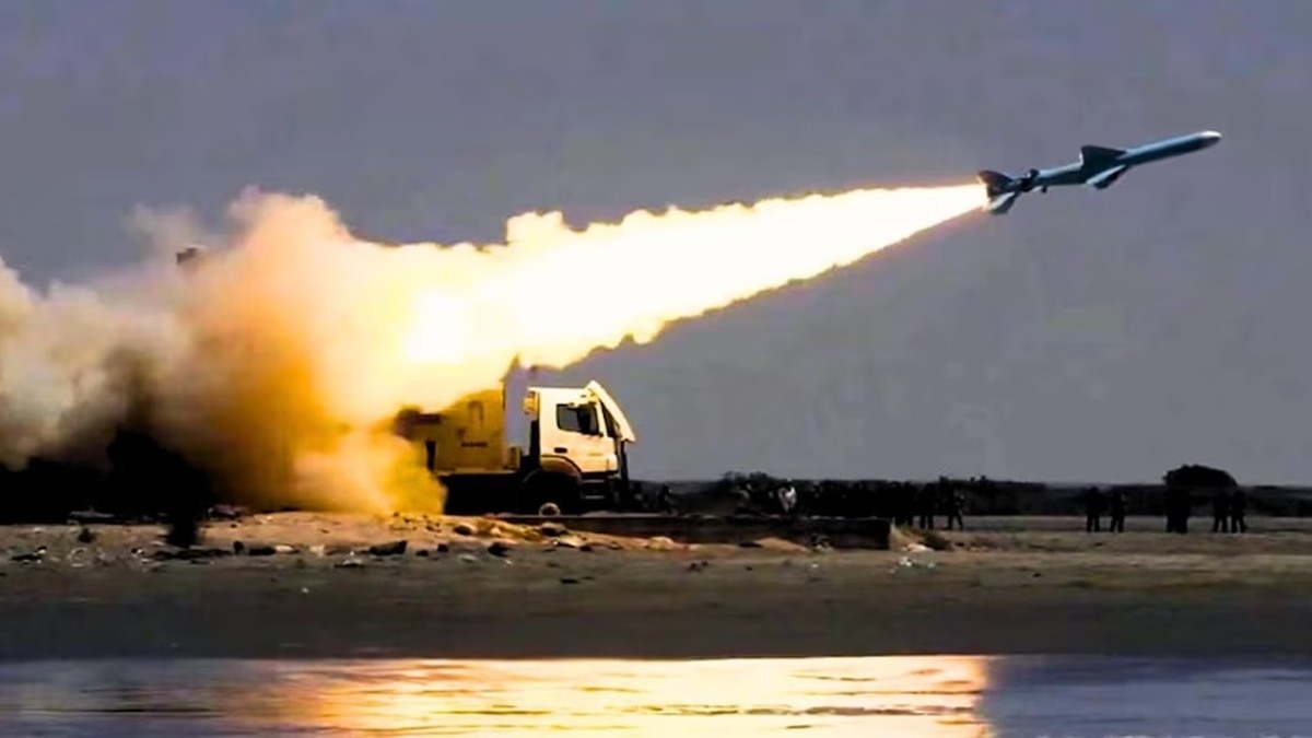
Fresh satellite images have shed new light on the chaotic US rescue mission of two crew members who went missing after Tehran downed an F-15E fighter jet earlier this month amid the conflict.
")
The wreckage of an American aircraft and a helicopter rotor in Isfahan (Reuters)

New Delhi,UPDATED: Apr 15, 2026 15:10 IST
Latest high-resolution satellite images from Iran have shed new light on the chaotic US rescue mission of two personnel who went missing after Tehran downed an F-15E Strike Eagle fighter jet earlier this month. The images, released by Soar Atlas, show multiple US aircraft wreckage at an abandoned dirt airstrip near Shahreza in Isfahan province, which houses Iran's key nuclear complex. These raise fresh questions on the real objective of the US operation, which involved an armada of 155 aircraft to rescue just two airmen.
While Donald Trump called it "one of the most daring rescue operations", the US provided scant details of its losses during the mission. The remote airfield is located around 40 km from the Isfahan nuclear complex, which holds Iran's primary stockpile of highly enriched uranium, key to making nuclear weapons.
Iran has alleged that it was a "failed" US operation to seize uranium. The reason it provided was simple. The area where the American airman was downed in Kohgiluyeh and Boyer-Ahmad province was far off from where US troops landed to rescue him. While the pilot and the weapons systems officer (WSO) were eventually rescued, the mission ran into major challenges beyond enemy lines.
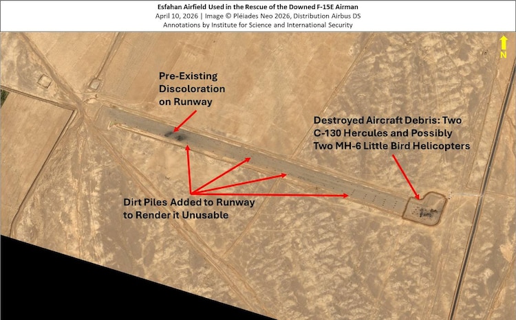
WHAT NEW SATELLITE IMAGES SHOW?
Satellite images now show wreckage of at least two US C-130 Hercules transport aircraft, and possibly two MH-6 "Little Bird" helicopters on the right side of the airfield.
Trump had admitted that the two C-130 aircraft, which ferried around 100 elite US forces, had to be blown up after they got stuck in the sandy desert terrain. This was done to prevent sensitive technology or equipment from falling into Iranian hands - a standard practice in combat.
However, no details were provided on the MH-6 helicopters, possibly deployed to provide close air support to the landing force. Considering that the US troops landed deep inside Iran, the helicopters were likely transported by the C-130 aircraft.
Iran, however, had claimed it struck the two US helicopters during the operation.

The helicopters could have been destroyed by the US troops, as there might have been no time or room to load them onto the replacement aircraft.
These helicopters have a maximum flight range of 420 km. The nearest US military base is around 400 km away near the Iraq border. Considering the risks, the US might have decided to destroy the helicopters at the site.
The new satellite images also reveal that in the days following the operation, Iran appears to have moved quickly to secure the airstrip. The images show a dirt security perimeter around the destroyed aircraft.
Additionally, piles of dirt have been placed throughout the runway, rendering it unusable for any future aircraft landings or operations.
Given its proximity to the Isfahan nuclear complex, this makes any potential future ground operation to seize the highly enriched uranium, believed to be stored in tunnels, more difficult.
In fact, experts suggested that Iran might use this tactic at other countryside airstrips across the country and near nuclear facilities. This will make any future US operation in Iran even harder and more dangerous.
- Ends
Published By:
Abhishek De
Published On:
Apr 15, 2026 15:10 IST